Presettlement Nature
- Jan 31
- 3 min read
The original land survey field notes from Wisconsin provide a rare glimpse into the state’s natural environment before widespread settlement. Surveyors working between 1832 and 1866 carefully documented the landscape, focusing on trees, native plants, and natural landmarks. These notes reveal how the land looked before farms, roads, and towns reshaped it. For residents of Sheboygan and nearby areas, these records offer a valuable connection to the region’s natural history and the ecosystems that once thrived here.


How Early Surveyors Described the Land
Surveyors from the federal General Land Office followed a strict grid system to divide Wisconsin into townships and sections. While their main goal was to map land for sale and settlement, they also recorded detailed observations about the natural environment. Their field notes often included descriptions of:
Tree species and density
Types of soil and terrain
Water sources such as rivers, lakes, and wetlands
Unique natural landmarks used as reference points
Trees were especially important to surveyors. They marked corners and boundaries using prominent trees, often noting the species and size. These “witness trees” served as anchor points for the grid system and helped future landowners identify property lines.


Trees as Anchor Points in the Survey
Surveyors frequently used native trees to mark section corners and other key locations. They recorded species like white pine, oak, maple, and basswood, noting their condition and size. For example, a surveyor might write: “White oak, 18 inches diameter, standing 10 links east of corner post.” These details helped create a reliable map that combined human-made boundaries with natural features.
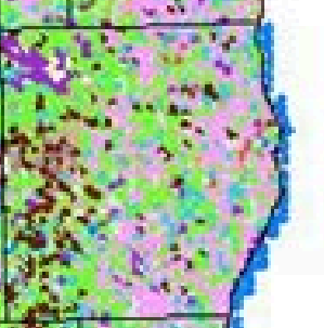
This practice also provides modern readers with clues about the original forest composition. In many parts of Sheboygan County, the notes show a mix of hardwoods and conifers, indicating diverse ecosystems. The presence of certain species also hints at soil types and moisture levels in different areas.


Descriptions of Presettlement Ecosystems
The field notes often describe the land as heavily forested with patches of open prairie or wetlands. Surveyors noted the quality of the soil, which influenced how settlers would later use the land. Some areas were rich with fertile loam, while others had sandy or rocky soil less suited for farming.
Wetlands and water bodies were common features. Surveyors recorded marshes, swamps, and streams, often noting the types of plants growing there. These wetlands supported species like tamarack and cedar, which thrived in saturated soils.
The notes also mention wildlife indirectly by describing the vegetation that supported it. For example, dense oak forests would have provided habitat for deer and other animals important to Native Americans and early settlers.
Trees Used As Anchors
Beech, Sugar Maple, White Pine, Ash, Oak, Birch, Red Oak, Maple Family, Paper Birch, Yellow Birch, Ironwood, Elm, Basswood, Tamarack, Black Walnut, Pine, White Oak, Black Oak, Black Ash, White Ash, Swamp Oak, Cedar, Willow, Cottonwood, Red Pine, Elder, Prickly Ash
Why These Notes Matter Today
For Sheboygan residents, the original survey field notes offer more than historical curiosity. They provide a baseline for understanding how the landscape has changed over nearly two centuries. Comparing these early descriptions with today’s environment reveals the impact of logging, agriculture, and urban development.
Landowners and conservationists use the notes to identify areas where native species once thrived and to guide restoration efforts. Knowing which trees and plants were common before settlement helps in selecting species for reforestation or habitat improvement projects.
Researchers also rely on these records to study Wisconsin’s ecological history. The detailed observations help reconstruct past ecosystems and understand how human activity has altered them.
Some entries included area descriptions
"Tamarack swamp, Poplar bushes and briars"
"Mostly swamp and timber"
"Indian Cornfield"
Accessing the Field Notes
The original handwritten survey notes and plat maps are now digitized and available online through the University of Wisconsin-Madison’s General Library System. This resource allows anyone interested in local history or land research to explore the early descriptions of Sheboygan’s natural environment.
Users can search by township and range to find specific surveys. The notes provide a direct connection to the land as it was before roads, farms, and towns changed the face of the region.
Preserving the Legacy of Wisconsin’s Natural Landscape
The first land survey field notes serve as a bridge between past and present. They remind us that before settlement, Sheboygan and surrounding areas were home to rich forests, wetlands, and diverse plant communities. These natural features shaped the lives of Native Americans and early settlers alike.
Today, these records encourage us to appreciate and protect the native species and ecosystems that remain. They also inspire efforts to restore parts of the landscape to a healthier, more natural state.
By understanding the presettlement environment, residents can better value the natural heritage beneath their feet and support sustainable land use for future generations. Exploring these early survey notes offers a unique way to connect with the land’s history and its ongoing story.


Comments